Cache Valley Explored by Captain Stansbury in October 1849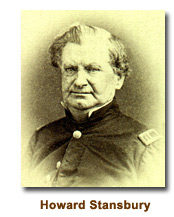
One of the early explorers of Cache Valley was Captain Howard Stansbury of the corps of topographical engineers of the U. S. Army. Acting under the direction of the bureau, he left Fort Leavenworth May 31st, 1849 for the purpose of making a survey of Great Salt Lake and the exploration of the Valley and its surroundings.
Concerning the exploration of Cache Valley Captain Stansbury wrote: “Following the same route which I had taken when coming up, we arrived at Bear River on the evening of the 11th and encamped. The examination of Cache Valley occupied several days. Crossing over the range of low, rounded hills through which Bear River has cut a passage, we entered this beautiful Valley then covered with a profusion of rich green grass and adorned and diversified by numerous clumps of willows. Our attempt to cross it directly was frustrated by meeting with a deep, quiet stream called the Muddy (Little Bear River), which rises in the hills dividing the southern end of the Valley from Ogden’s Hole and winds through the tall grass without banks until it discharges its waters in Bear River just before the stream enters the Valley of Salt Lake. We were in consequence driven some eight miles to the south, and effected our crossing where the Valley is full of swampy springs, affording abundance of good sweet water and excellent grass. Speckled trout of large size abound in the streams. After crossing the Muddy, we skirted the east side of the Valley for thirty-five miles in a northerly direction, crossing successively Blacksmith’s Fork, Logan’s Fork, High Fork, Gros Bois and Rush Creek, all tributaries of Bear River, which later stream traverses the Valley from the north until it breaks through the range forming its western boundary and enters that of the lake. The streams of the east side take their rise in a heavy range running to the north and constituting the eastern limit of the Valley which has an average width of about ten miles. The canyons they form before leaving the mountains abound in same time advantageous sites for the erection of mills. These ravines abound in fine timber in quantities sufficient for fuel and building purposes.”
 “As the object of the reconnaissance was principally to ascertain what were the capabilities of the Valley to afford sustenance for a military post, if established in this vicinity, the examination was a general one and was not directed to the selection of any particular portion of it for such a purpose. At the time the reconnaissance was made, all the information that could be obtained from the oldest mountain men, induced both Colonel Porter and myself to believe that it was one of the most eligible spots in the whole country for wintering stock. It had been a rendezvous for the American Fur Company for many years and stock had been wintered there by them with great advantage. The snow was seldom deep and the cattle not only retained their flesh, but grew fat during the winter. So flattering were the appearances and so great the advantage offered by this lovely Valley that nearly the whole number of cattle and mules belonging to the cantonment—Fort Hall— were, upon the return of Colonel Porter to that post, driven down there under the care of a proper guard, to be wintered. The season, however, proved unusually severe: the snow fell in the Valley to a depth unprecedented: and more that one-half of the heard, in which were included some of my own animals, perished in consequence. The fact of the liability of the Valley to a similar occurrence in the future will doubtless have its due influence in finally deciding upon its eligibility as the best site for a post in the vicinity of Salt Lake.”
“The Soil of the Valley is very rich, being principally alluvial with a great deal of vegetable mould. Facilities for irrigation are very great and water could be commanded to a large extent for farming purposes. Any amount of hay might be cut without in the least interfering with the range for cattle. The only objection to this as a most desirable spot for settlement is the danger from snow; and even this might be in a great degree obviated by the erection of suitable sheds for protection of the stock during the more severe portions of the season. These seldom last more that a few weeks.”
“Should the road to which I have already adverted be established from Fort Bridger, through the Valley of Blacksmith’s Fork, it would at once attract to it the travel to Oregon and California; a fact which would have its due weight in the selection of a site for a military post for the protection of this part of the country.”